
Day 2 Recap | Wildfire: Weather, Water, Weeds, Wildlife
- Jan 25, 2022
- 5 min read
Updated: Jan 27, 2022


Over the course of three days, Council for Watershed Health hosted 40 speakers, 9 poster presenters and hundreds of attendees for nearly 12 hours of wildfire-focused presentations and discussions. Presenters are experts in their fields and provided succinct overviews on a wide range of topics, drawing nearly100 questions from attendees. Video recordings, tools and resources, and a record of the audience Q&A are linked throughout this blog. For our final proceeding, this blog provides a summary of the Symposium’s virtual presentations and discussions. Thank you again to all who made our Wildfire: Weather | Water | Weeds | Wildlife Symposium a success! And a special thank you to UCANR’s Sabrina Drill for her tremendous support.
DAY 2 SUMMARY | SEPTEMBER 30, 2021 | 9AM-1PM
Themes of the second day were wildfire impacts to plants and wildlife and how we can contribute to fire prevention, ecological recovery, and forward planning under climate change. We learned about the increase in wildfires since 1980. The ten most costly US wildfires, adjusted for inflation, occurred in California. Until the early 2000s, Southern California was the poster child for large fires. Yet since 2010, extremely large fires in Northern California have been on the rise. Humans have greatly changed fire frequencies and patterns in California where Chaparral now burns more frequently than forests, departing from its historical norms and contributing to six of the ten most destructive fires in 2020. Chaparral itself is more fire resistant the older it gets so the removal of Chaparral as “vegetation management” does more harm than good. Ultimately “brush clearance” combined with large, frequent fires are severely disturbing vegetative ecosystems, making way for invasive weeds and causing a positive feedback loop through the grass-fire cycle. Efforts discussed to control the grass-fire cycle included monitoring, surveying and sustainable, ecologically sound treatment.
Type conversion from Chaparral to invasive weeds and grasses not only contributes to the grass-fire cycle, but also reduces connectivity between habitats, bringing us to the impacts of fire on wildlife. Fire degrades habitats impacting vegetation, aquatic species, birds and mammals. Mammals such as coyotes, mountain lions, bobcats, and squirrels are being monitored and have been studied to understand how their activity changes from pre-fire to post-fire conditions. Following fire, food sources are impacted, displacing some wildlife into human communities. During and following a fire, aquatic species suffer from impaired water quality and debris-filled channels. We heard about the rescue and rehabilitation of species like the endangered Mountain Yellow Legged Frog that were relocated to controlled environments and healthier creek sites. Going forward, data, maps and tools, like those produced by the Climate Resilient Connectivity Project, can help decision makers understand and plan for fire impacts on habitat linkages under climate change.
Presentation Recaps
Council for Watershed Health (CWH) Executive Director, Eileen Alduenda, and CWH Board President, Steve Arakawa, hosted the initial welcome. For our Land Acknowledgement, Mark Villasenor, Tribal Vice President of the Fernandeno Tataviam Band of Mission Indians, shared a tribal welcome song, providing a very special start to the day.
Our first panel, moderated by Sabrina Drill, included Hugh Safford from the US Forest Service, Alexandra Syphard from Vertus Wildfire, Rachel Wing from California Botanic Garden, and Chris McDonald from UC Cooperative Extension. Hugh Safford set the stage helping us understand how fire regimes are changing in California and shared that Chaparral vegetation types were included in six of the ten most destructive US wildfires in 2020. Alexandra Syphard continued the narrative sharing that “chaparral historically burned every 25-65 years.” However, due to shorter intervals between fires, fire-driven vegetation type conversion is taking place wherein biodiverse chaparral shrublands become degraded landscapes made up primarily of invasive weeds resulting in a grass-fire cycle. When it comes to Chaparral, Marti Witter shared that these landscapes are undervalued, not easily replaceable, and should not be “mindlessly cleared” through “brush clearance”. Witter argues that an over-emphasis on vegetation management ignores current science, does little to protect homeowners and that those resources would be better put toward ignition prevention in the wildland urban interface (WUI), conservation, and home hardening. Rachel Wing presented work being done with the California Botanic Garden and the Angeles Forest Service to control invasive species in the Angeles Forest. This effort, stemming from the Burn Area Emergency Response (BAER) program, is focused on checking for new introductions of invasive species and surveying and treating dozer lines where weeds spread post-fire, during fire suppression activities, or in fire-disturbed areas. Chris Mcdonald, Natural Resources Advisor with UC Extension, shared that annual grasses which are replacing our shrublands are much more flammable ignition sources in our urban wildland interface. To reduce fire, Chris shared the importance and differences between prevention, chemical treatment, livestock grazing, mulching, mowing and handtools or manual control. Sabrina Drill facilitated an intriguing and important dialogue about how we move forward to ensure policies and practices are based in current science.
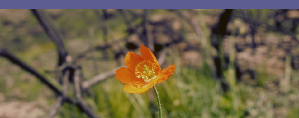
After a short break, Richard Rachman, Plant Ecologist and Graduate Student at Cal State Northridge shared wonderful photos and the natural history and biology of wildflowers that follow wildfire (follow Richard @a_wandering_ecologist on Instagram!). These wildflowers inspired the names of the Symposium’s sponsorship levels!
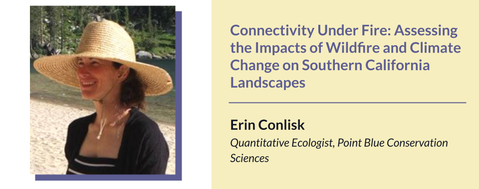
In our second panel, Travis Longcore, with the Urban Wildlands Group, provided moderation and discussion full of great information with an emphasis on the impact of fires to animals and wildlife. Presenters included Ed Pert from the South Coast Region of the California Department Fish and Wildlife, Carlton Rochester from the U.S. Geological Survey's Western Ecological Research Center, Kendall Calhoun from UC Berkeley's Department of Environmental Science, Policy, & Management, Megan Jennings from San Diego State University's Conservation Ecology Lab and Erin Conlisk from Point Blue Conservation Science. Ed Pert, Regional Manager for the South Coast Region of the California Department Fish and Wildlife, shared impacts of wildfire on wildlife. Rescues and rehabilitation are major parts of their efforts. He shared a novel approach of using Tilapia skin to treat burned paws. Fish rescues are also common, where fish are moved to refuges to ensure they can be returned back to their burned watersheds in the future. Carlton Rochester shared about emergency salvage of the endangered Mountain Yellow Legged Frogs after fire and the science and models the agency uses to predict wildlife habitat impacts. Kendall Calhoun shared his wildlife monitoring efforts after the Mendocino Complex Fire. Kendall is studying how reductions of cover can impact the movement of wildlife postfire. Using remote cameras and comparing wildlife in burned and unburned areas, his research is shedding light on how bird and mammal communities respond to wildfire in shrubland and oak woodland communities. Megan Jennings shared her research following carnivores after fire in San Diego County (mountain lions, bobcats and coyotes) and how fire frequency combined with vegetation conversion to invasive grasses is reducing suitable connectivity. The Climate Resilient Connectivity Project mapped connectivity throughout Southern California and is being used by agencies as a planning tool to create linkages between wildlife habitat throughout the region. Erin Conlisk of Point Blue Conservation Science, presented on the Climate Connectivity Network further, sharing that 15 years is needed for shrubland/chaparral fire recovery and that low elevation linkage areas are having more fire while high elevations are seeing less fire. Finally, Erin walked us through maps sharing refugia values throughout Southern California.
Day 2 Resources
- MANY THANKS TO OUR SYMPOSIUM PARTNERS & SPONSORS! -

Our sponsor levels are named after wildflowers that grow abundantly following a fire!


Comments